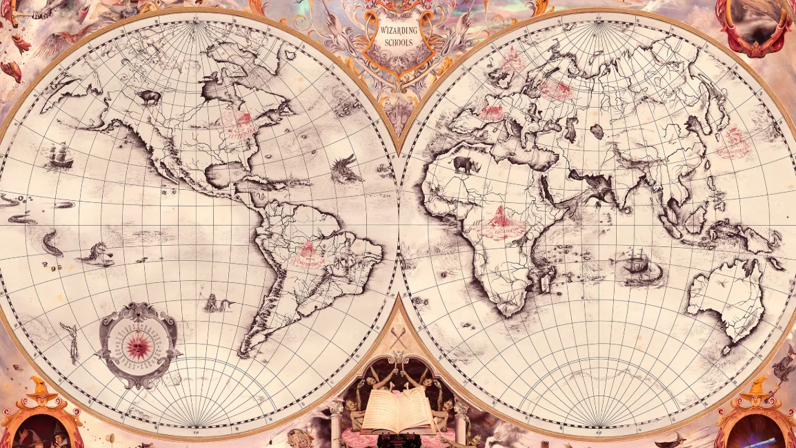
Wizarding Schools Map
Published November 16, 2026
Wizarding Schools Map refers to fanart depictions of the Harry Potter school system that assign each of the 11 wizarding academies a massive chunk of real-world territory. After J.K. Rowling published her Pottermore post in January 2016 naming the schools and their regions, fans turned the vague geography into illustrated maps and began mocking the lopsided student-to-landmass ratios. By early 2020, Twitter and 4chan threads were tearing into the map for giving Europe four schools while handing all of Africa to a single institution.
Overview
Wizarding Schools Map covers a loose collection of fan-drawn world maps that take J.K. Rowling's eight named wizarding academies and color in the enormous geographic regions each one supposedly serves1. A typical version shades Hogwarts over the British Isles, Beauxbatons across France, Durmstrang across Northern Europe, Ilvermorny over North America, Castelobruxo across all of South America, Uagadou across the entire African continent, Mahoutokoro in Japan and Koldovstoretz across Russia2.
The joke lives in the math. Commenters pair the map with population figures and point out that one Ugandan school is apparently teaching every magical child in Africa, while Europe gets four separate institutions for a much smaller population3. The format reads as both fandom reference and critique, and posts tend to swing between earnest 'which school would you attend' quizzes and sarcastic takedowns of the lopsided worldbuilding2.
Gallery
Origin & Background
How It Spread
Timeline
How to Use This Meme
Posts in this format typically share a colored world map with each wizarding school's name labeled over its assigned region, then add a caption asking viewers which academy they'd attend based on where they live5. A common convention is to point out the population imbalance in the replies, often by listing the population of one continent next to the United Kingdom's3.